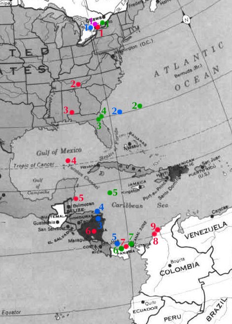
Four juvenile peregrine falcons from Ontario were monitored via satellite telemetry from late summer 1999 through to summer 2000. Click on each bird below to access detailed individual travel diaries (including maps), or check out the map below for a summary of their southward journeys. For more background information on how and why we are undertaking Project Track-'em, click here.
|
For more recent results from Project Track-'em, click here. |
Eco (from Richmond Hill) |
Rouge (from Richmond Hill) |
Lincoln (from Guelph) |
Nate (from Richmond Hill) |
Thanks to our 1999/2000 Project Track-'em partners and sponsors:
Friends of the Environment Foundation
EcoAction 2000
Ontario Ministry of Natural Resources
Royal Canadian Geographical Society
Canadian Wildlife Service
Canadian Space Agency
Ontario Hawking Club
Helen M. Peacock Foundation
Skip Ambrose
University of Guelph
McGill University